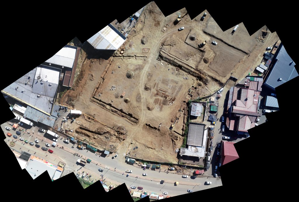
An ideal solution for tracking and documenting the progress of engineering and agricultural projects.
Record progress in high-definition video or merge captured images into a single comprehensive view of the desired area.
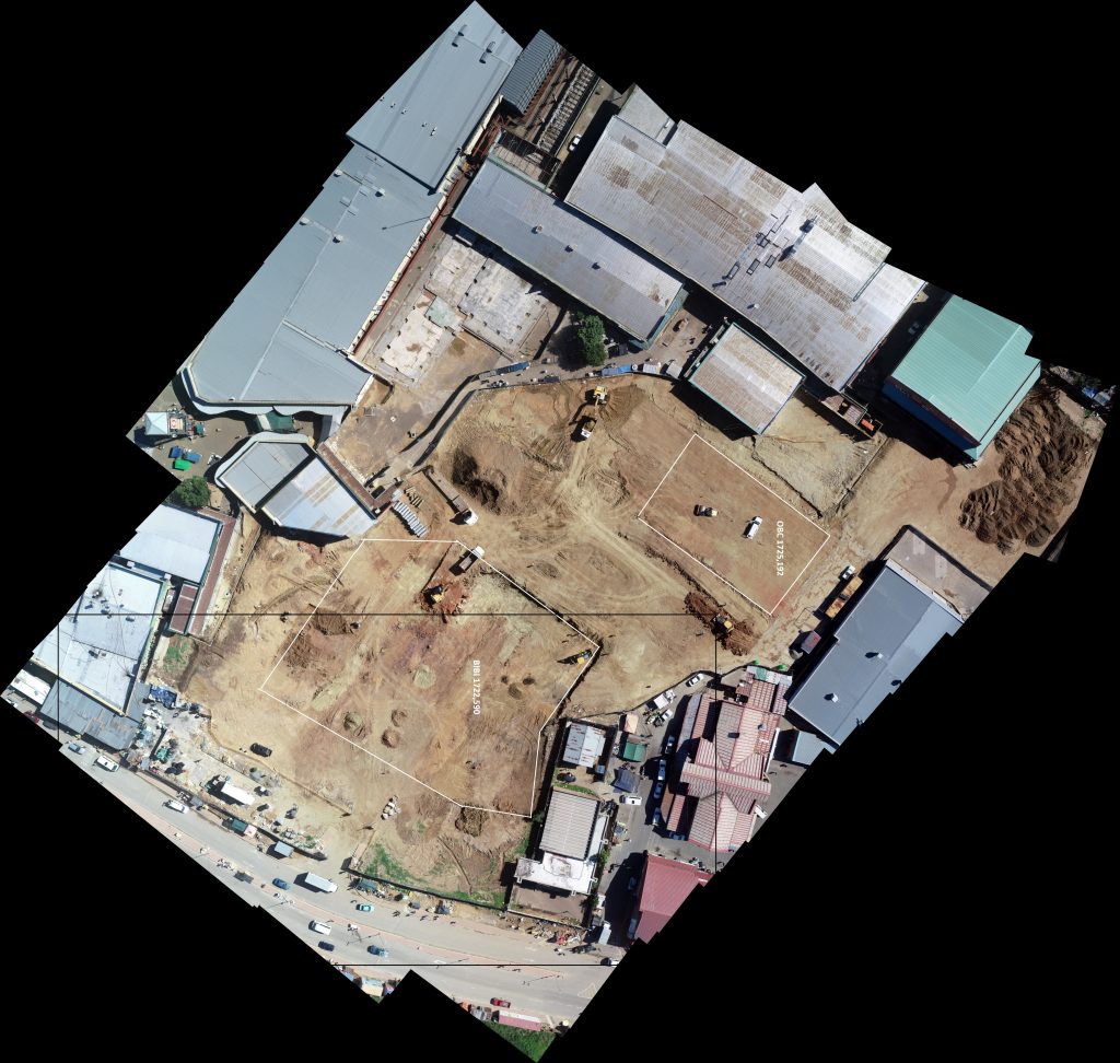
By utilizing overlapping images and photogrammetry techniques, a 3D model can be generated. This model becomes a valuable tool for measurements if a reference measurement from the site is available.